The Ullswater Way is a recently opened route which loops around Ullswater lake. The 20 mile hike is well marked and follows lakeside paths, woodland trails and ridgeline footpaths, all with spectacular views across the lake and surrounding fells.
Start and End Location: Pooley Bridge Car Park
Start Postcode: CA10 2NE
Distance: 33 km
Time: 7-10 hours
Facilities: Public toilets in Pooley Bridge, Aira Force and Glenridding
Map: The majority of the route is well signposted but a map is always useful (OS OL5 and the Ullswater Way site provides a more basic map).
Grade: Easy, with well marked paths for the majority of the route.
Starting Point and Which Direction?
The Ullswater Way can be started at any point and walked in either direction. However, I think the best views are gained from walking anticlockwise, starting at Pooley Bridge.
Pooley Bridge to Aira Force
The first section of the walk begins on the north-east side of Pooley Bridge.
The easy to follow ‘Ullswater Way' signs lead you through woodland, past Waterfoot park and across farming fields.


The route follows the road for a short section before turning left through a wooden gate and crossing fields once again.
After a short ascent, the path reaches Swinburn's Park. The climb through the woods offers wonderful views across Ullswater.


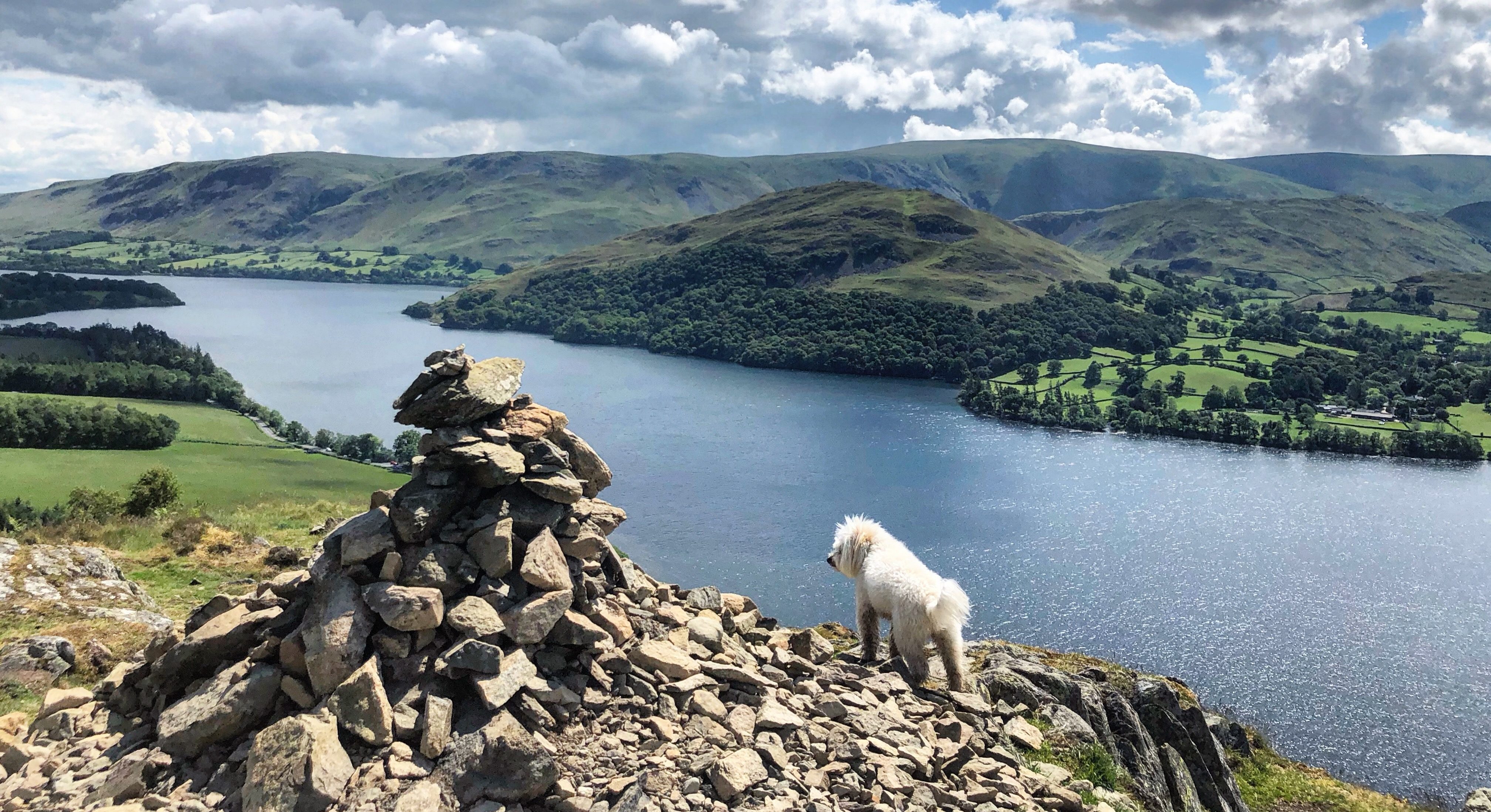
At the edge of the wood, the route offers two options; a climb to Gowbarrow Fell or a high level path traversing the hillside. As I have already bagged Gowbarrow Fell, I followed the path looping around the hillside, with brilliant views of the lake and the Helvellyn range.

The path approaches Aira Force and this is the only section where the route isn’t clearly signposted; at the junction, turn right to visit Aira Force waterfall or turn left to go straight to the National Trust car park and toilets.

Aire Force to Glenridding and Patterdale
From Aira Force National Trust car park, the path turns right and follows the road before bearing right through a wooden gate.

Continue along the gravel path through the park.

After crossing the road, the path runs alongside the lake before joining the pavement to Glenridding and then on to Patterdale.

Patterdale to Howtown
After leaving Patterdale, the road bends around to the right. There's a signpost for the Ullswater Way, pointing left.

Follow the path between the buildings to reach a wide farm track.

The route continues through a farm and then bears left. The well defined stone path runs along the east side of Ullswater to Howtown pier.

Howtown to Pooley Bridge
Directly behind Howtown pier, the route crosses the road and climbs through farming fields before turning left and eventually following a dry-stone wall.

After once again crossing farming fields, the path bears left around a farm and then turns left down a track towards the lake.

Turn right and follow the road to reach a camp site. Turn left into the camp site and continue on the lakeside track to return to Pooley Bridge.
