This high-level ridge walk offers stunning views across Crummock Water, Buttermere and the surrounding fells. The ridge is fairly straightforward, but this makes it no less spectacular. Scrambling across the loose, ruby red rocks to reach Red Pike is challenging and I would recommend picking a dry day for this route.
Start and End Location: Car park behind the Bridge Hotel in Buttermere. Approaching Buttermere from the north on the B5289, turn sharp right at the Bridge Hotel and take the first right to the car park.
Start Postcode: CA13 9XA approx.
Distance: 11.5km
Time: 4-5 hours
Facilities:Toilets in the car park
GPX Download: Link below map
Grade: Hard Mountain Walk
From the car park, follow the road back to The Fish Inn. Go through the wooden gate to the left of the pub and follow the gravel footpath to the edge of Buttermere lake, ignoring the right-hand fork.
Cross the footbridges and, with Buttermere lake to the left, continue straight ahead on the stone steps, climbing through Burtness Wood.

After approximately half a mile, the path reaches a wooden gate and the edge of the treeline. Go through the gate and follow the stone path, with great views back across Buttermere and Fleetwith Pike.

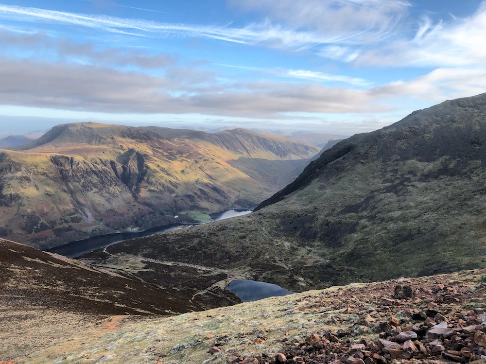
The path becomes increasingly steep and bears to the right to meet Sourmilk Gill. Follow the path to climb alongside the gill to reach the edge of Bleaberry Tarn.

Take the well-defined, right-hand path towards Red Pike. The path reaches The Saddle, with Dodd to the north-east and Red Pike to the south-west.
Turn left to continue to Red Pike.
The footpath quickly becomes very steep and more challenging; loose red scree and narrow gullies mark the final ascent to the summit.

The views however, definitely make the climb worthwhile!


From the summit, which is marked by a large cairn, head south-east. The path runs along the edge of Chapel Crags.

The final stretch of the path is hard to follow as the ridge is covered in scattered rocks. Essentially, keep going straight ahead to reach the summit of High Stile, which is marked by a large pile of stones.

From the summit, head south. On a clear day, the ridge path can be seen to your left.

The path is wide, well-defined and follows Comb Crags to reach High Crag summit.
From the summit, continue straight ahead. The descent steeply zigzags downhill. The picture below is looking back towards at the footpath and gives you an idea of how steep it is!

The footpath eventually levels out and crosses grassy moorland, before climbing again with great views of Haystacks ahead.

At the junction, turn left to follow Scarth Gap Pass directly down to reach Buttermere lake edge.

Turn left and follow the wide gravel, shoreline path into the woods.

At the junction, keep left and follow the path to reach the footbridge.
Retrace your steps to return to the car park.